Landwirtschaft/en: Unterschied zwischen den Versionen
(Übernehme Bearbeitung einer neuen Version der Quellseite) |
Tschug (Diskussion | Beiträge) K |
||
| (7 dazwischenliegende Versionen desselben Benutzers werden nicht angezeigt) | |||
| Zeile 1: | Zeile 1: | ||
__NOTOC__ |
__NOTOC__ |
||
| − | == |
+ | == Agriculture == |
| − | <p>[[File:Landwirtschaft.jpg|alt= |
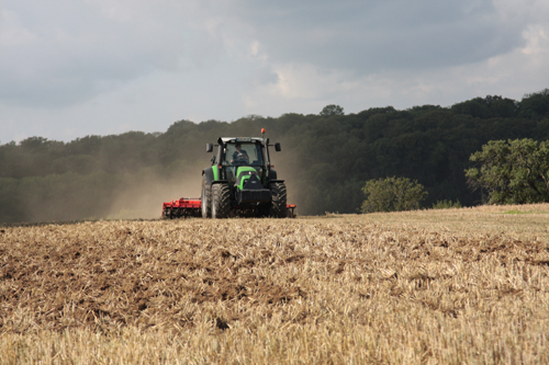
+ | <p>[[File:Landwirtschaft.jpg|alt=Agriculture|600px|link=//{{SERVERNAME}}/mapbender/frames/index.php?lang=de&gui_id=Geoportal-SL-2020&WMC=3439]]</p> |
== Viewer == |
== Viewer == |
||
| − | <p><strong>[//{{SERVERNAME}}/mapbender/frames/index.php?lang=de&gui_id=Geoportal-SL-2020&WMC=3439 |
+ | <p><strong>[//{{SERVERNAME}}/mapbender/frames/index.php?lang=de&gui_id=Geoportal-SL-2020&WMC=3439 Go to application: ‘Agrarian statistics’]</strong></p> |
| − | == |
+ | == Description == |
| + | <p>Saarland’s Agricultural Structural Development Plan was created in the 1999–2000 period and constitutes a planning framework for agricultural activities in Saarland.<br /> |
||
| − | <p>Mit der Agrarstrukturellen Entwicklungsplanung für das Saarland, die in den Jahren 1999 - 2000 erstellt wurde, liegt eine Rahmenplanung für die saarländische Landwirtschaft vor.<br /> |
||
| + | Alongside the collection of comprehensive data for stocktaking and a status quo analysis, the expert opinion also includes guidance for the future development of agriculture and therefore also for the development of rural spaces as well as cultural landscape use.<br /><br /> |
||
| − | Neben der Erhebung umfangreicher Daten zur Bestandsaufnahme und einer Analyse der Ist-Situation enthält das Gutachten Leitbilder für die zukünftige Entwicklung der Landwirtschaft und damit auch für die Entwicklung ländlicher Räume sowie der Nutzung der Kulturlandschaft.<br /><br /> |
||
| + | From the starting point of a state-wide survey map containing an overview of agrarian spaces, agricultural facilities larger than 30 ha and proposed areas for agricultural priority and reserved areas, zooming further into the map also reveals additional layers of information. These include a detailed representation of spatial structure including information about real-world usage, suitability for agricultural use and an optional overlay showing refuges in agricultural areas.<br /> |
||
| − | <div class="mw-translate-fuzzy"> |
||
| + | The display of map content is adjusted to match the current zoom level and a variety of background maps are also available (1:25,000, 1:50,000 topographical maps). |
||
| − | Ausgehend von einer landesweiten Übersichtskarte mit einem Überblick über die Agrarräume, die Landwirtschaftsbetriebe über 30 Hektar und Vorschlagsflächen für landwirtschaftliche Vorrang- und Vorbehaltsgebiete, erschließen sich beim Hineinvergrößern weitere Informationsebenen. Hier findet sich eine detaillierte Raumgliederung mit Darstellungen der Realnutzung, der landwirtschaftlichen Nutzungseignung und eine zuschaltbare Darstellung der landwirtschaftlichen Rückzugsgebiete.<br /> |
||
| − | In Abhängigkeit vom Darstellungsmaßstab wird die Darstellung der Karteninhalte angepasst und es stehen unterschiedliche Hintergrundkarten zu Verfügung (TK 50, TK 25). |
||
</p> |
</p> |
||
| − | </div> |
||
== Downloads == |
== Downloads == |
||
| + | Text of the expert opinion |
||
| − | Textband zum Gutachten |
||
<ul class="box" style="margin-top: 0px;"> |
<ul class="box" style="margin-top: 0px;"> |
||
| − | <li class="download">[//{{SERVERNAME}}/mediawiki/images/4/4b/Aepsaar.pdf |
+ | <li class="download">[//{{SERVERNAME}}/mediawiki/images/4/4b/Aepsaar.pdf Text of the expert opinion]</li> |
</ul> |
</ul> |
||
| + | Downloadable maps |
||
| − | Die Karten zum Download |
||
<ul class="box" style="margin-top: 0px;"> |
<ul class="box" style="margin-top: 0px;"> |
||
| − | <li class="download">[//{{SERVERNAME}}/mediawiki/images/e/e2/VIEHBESATZRAUHFUTTERFRESSER.pdf |
+ | <li class="download">[//{{SERVERNAME}}/mediawiki/images/e/e2/VIEHBESATZRAUHFUTTERFRESSER.pdf Map 1: Grazing livestock density]</li> |
| − | <li class="download">[//{{SERVERNAME}}/mediawiki/images/a/ac/ANZAHLBETRIEBE2000.pdf |
+ | <li class="download">[//{{SERVERNAME}}/mediawiki/images/a/ac/ANZAHLBETRIEBE2000.pdf Map 2: Number of agricultural companies over 30 ha, LF 1999/2000]</li> |
| − | <li class="download">[//{{SERVERNAME}}/mediawiki/images/5/58/MILCHERZEUGUNG.pdf |
+ | <li class="download">[//{{SERVERNAME}}/mediawiki/images/5/58/MILCHERZEUGUNG.pdf Map 3: Annual milk production]</li> |
| − | <li class="download">[//{{SERVERNAME}}/mediawiki/images/f/fe/SAUM.pdf |
+ | <li class="download">[//{{SERVERNAME}}/mediawiki/images/f/fe/SAUM.pdf Map 4: Proportion of KULAP/SAUM areas in grasslands]</li> |
| − | <li class="download">[//{{SERVERNAME}}/mediawiki/images/d/d2/ANZAHLBETRIEBE2010.pdf |
+ | <li class="download">[//{{SERVERNAME}}/mediawiki/images/d/d2/ANZAHLBETRIEBE2010.pdf Map 5: Number of companies over 30 ha in the cadastral divisions – 2010 forecast]</li> |
</ul> |
</ul> |
||
| − | == |
+ | == Contacts == |
| + | '''Ministry for the Environment, Climate, Mobility, Agriculture and Consumer Protection'''<br /> |
||
| − | '''Ministerium für Umwelt und Verbraucherschutz'''<br /> |
||
| + | Section B Agriculture, Food, Rural Development<br /> |
||
| − | Referat B/2 "Landwirtschaftliche Erzeugung, Agrarmärkte"<br /> |
||
Alfred Hoffmann<br /> |
Alfred Hoffmann<br /> |
||
| − | [mailto: |
+ | [mailto:a.hoffmann@umwelt.saarland.de Email]<br /> |
| − | + | Phone: +49 681 501-1887 |
|
Aktuelle Version vom 2. Januar 2023, 11:19 Uhr
Agriculture
Viewer
Go to application: ‘Agrarian statistics’
Description
Saarland’s Agricultural Structural Development Plan was created in the 1999–2000 period and constitutes a planning framework for agricultural activities in Saarland.
Alongside the collection of comprehensive data for stocktaking and a status quo analysis, the expert opinion also includes guidance for the future development of agriculture and therefore also for the development of rural spaces as well as cultural landscape use.
From the starting point of a state-wide survey map containing an overview of agrarian spaces, agricultural facilities larger than 30 ha and proposed areas for agricultural priority and reserved areas, zooming further into the map also reveals additional layers of information. These include a detailed representation of spatial structure including information about real-world usage, suitability for agricultural use and an optional overlay showing refuges in agricultural areas.
The display of map content is adjusted to match the current zoom level and a variety of background maps are also available (1:25,000, 1:50,000 topographical maps).
Downloads
Text of the expert opinion
Downloadable maps
- Map 1: Grazing livestock density
- Map 2: Number of agricultural companies over 30 ha, LF 1999/2000
- Map 3: Annual milk production
- Map 4: Proportion of KULAP/SAUM areas in grasslands
- Map 5: Number of companies over 30 ha in the cadastral divisions – 2010 forecast
Contacts
Ministry for the Environment, Climate, Mobility, Agriculture and Consumer Protection
Section B Agriculture, Food, Rural Development
Alfred Hoffmann
Email
Phone: +49 681 501-1887
