Von Tschug hochgeladene Dateien
Aus Geoportal
Diese Spezialseite listet alle hochgeladenen Dateien auf.
| Datum | Name | Vorschaubild | Größe | Beschreibung | Versionen |
|---|---|---|---|---|---|
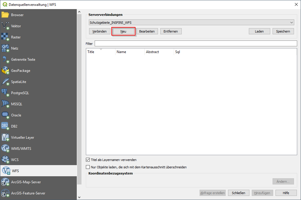
| 10:50, 12. Mai 2020 | QGIS WFS anlegen.png (Datei) |  |
45 KB | 1 | |
| 10:49, 12. Mai 2020 | QGIS WFS Layer Button.png (Datei) |  |
1 KB | 1 | |
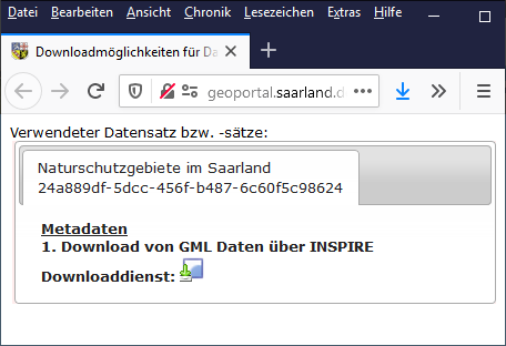
| 10:21, 12. Mai 2020 | Downloadmöglichkeiten Naturschutzgebiete.png (Datei) |  |
30 KB | 1 | |
| 10:21, 12. Mai 2020 | Vector Download.png (Datei) |  |
1 KB | 1 | |
| 08:18, 12. Mai 2020 | Download Kartenviewer.png (Datei) |  |
2 KB | 1 | |
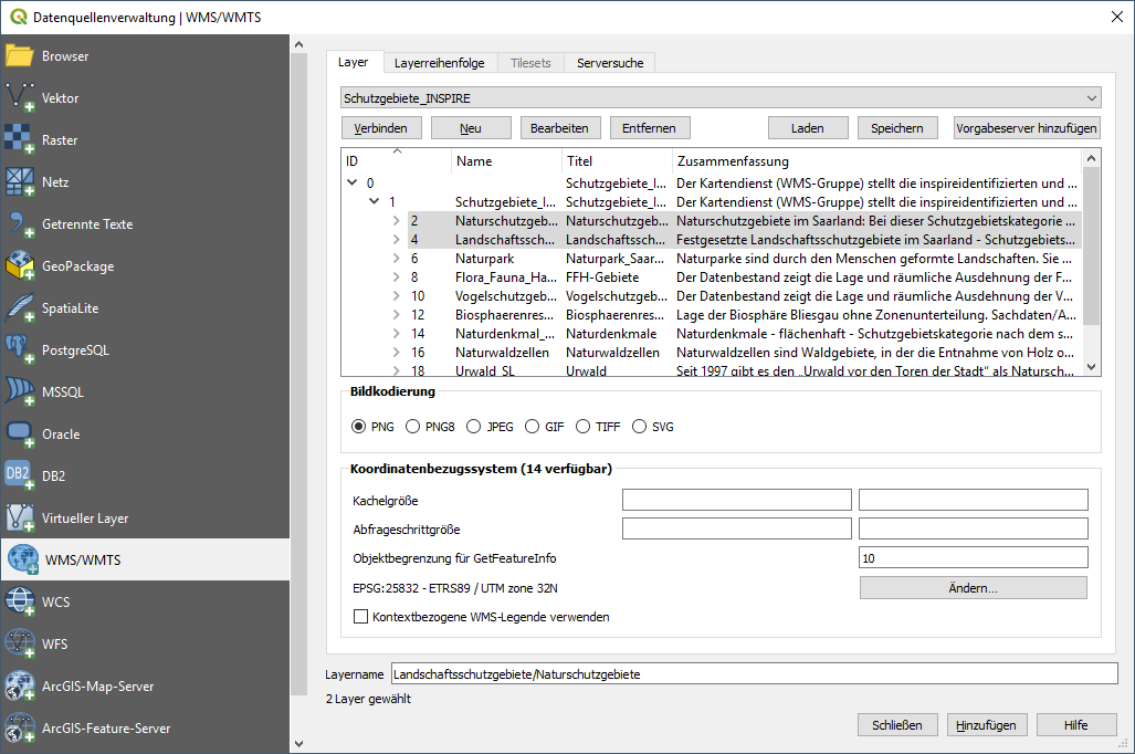
| 13:00, 11. Mai 2020 | QGIS WMS.png (Datei) |  |
70 KB | 1 | |
| 13:00, 11. Mai 2020 | QGIS WMS neu.png (Datei) |  |
18 KB | 1 | |
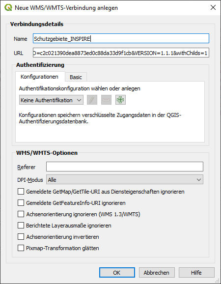
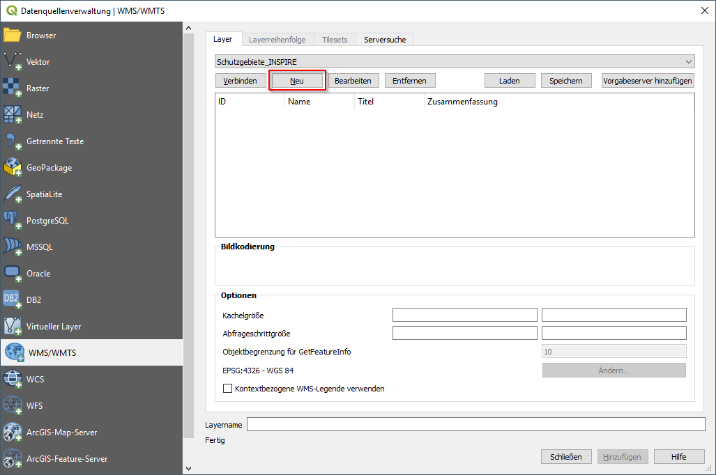
| 13:00, 11. Mai 2020 | QGIS WMS anlegen.png (Datei) |  |
49 KB | 1 | |
| 12:59, 11. Mai 2020 | QGIS WMS Button.png (Datei) |  |
1 KB | 1 | |
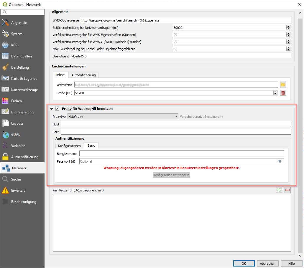
| 12:58, 11. Mai 2020 | QGIS Netzwerkeinstellungen.png (Datei) |  |
52 KB | QGIS 3.10.4 | 1 |
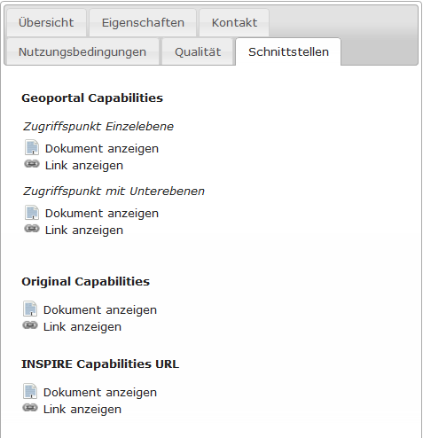
| 12:58, 11. Mai 2020 | Metadaten Schutzgebiete Schnittstellen.png (Datei) |  |
17 KB | 1 | |
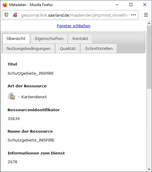
| 12:58, 11. Mai 2020 | Metadaten Schutzgebiete.png (Datei) |  |
30 KB | 1 | |
| 12:05, 7. Mai 2020 | Mobilemap2 schmal.png (Datei) |  |
330 KB | 1 | |
| 12:00, 7. Mai 2020 | Mobilemap2 schmal menü.png (Datei) |  |
16 KB | 1 | |
| 11:59, 7. Mai 2020 | Mobilemap2 groß.png (Datei) |  |
905 KB | 1 | |
| 13:40, 6. Mai 2020 | Mobilemap2.png (Datei) |  |
828 KB | 1 | |
| 08:48, 6. Mai 2020 | Times red.png (Datei) |  |
612 Bytes | Dienst ist nicht verfügbar | 1 |
| 08:47, 6. Mai 2020 | Exclamation.png (Datei) |  |
669 Bytes | Dienst ist verfügbar, Metadaten vor kurzem geändert | 1 |
| 08:47, 6. Mai 2020 | Check green.png (Datei) |  |
656 Bytes | Dienst ist verfügbar | 1 |
| 08:15, 6. Mai 2020 | Request permission.png (Datei) |  |
700 Bytes | Freischaltung beantragen | 1 |
| 08:13, 6. Mai 2020 | Locked.png (Datei) |  |
823 Bytes | Gesperrt | 1 |
| 14:40, 5. Mai 2020 | Open Map zoom.png (Datei) |  |
927 Bytes | öffnet Kartenviewer mit Zoom | 1 |
| 14:39, 5. Mai 2020 | Open Map.png (Datei) |  |
396 Bytes | öffnet Kartenviewer ohne Zoom | 1 |
| 14:39, 5. Mai 2020 | Network access.png (Datei) |  |
507 Bytes | Landesdatennetz | 1 |
| 14:38, 5. Mai 2020 | Open Capabilities.png (Datei) |  |
621 Bytes | Capabilities | 1 |
| 14:38, 5. Mai 2020 | Average availability.png (Datei) |  |
826 Bytes | durchschnittliche Verfügbarkeit | 1 |
| 14:37, 5. Mai 2020 | Feature info.png (Datei) |  |
590 Bytes | beinhaltet Feature-Info | 1 |
| 14:36, 5. Mai 2020 | Show.png (Datei) |  |
633 Bytes | Anzeigen | 1 |
| 14:36, 5. Mai 2020 | Download.png (Datei) |  |
476 Bytes | Downloadassistent | 1 |
| 14:35, 5. Mai 2020 | Open-data.jpg (Datei) | 5 KB | 1 | ||
| 14:35, 5. Mai 2020 | Logged.png (Datei) |  |
743 Bytes | Protokolliert | 1 |
| 14:35, 5. Mai 2020 | Licence.png (Datei) |  |
624 Bytes | Nutzungsrechte | 1 |
| 14:34, 5. Mai 2020 | Date.png (Datei) |  |
451 Bytes | Datumsangabe | 1 |
| 14:34, 5. Mai 2020 | Organisation.png (Datei) |  |
489 Bytes | Datenanbieter | 1 |
| 14:33, 5. Mai 2020 | Views.png (Datei) | 643 Bytes | 1 | ||
| 14:32, 5. Mai 2020 | Search application.png (Datei) | 3 KB | Anwendungen | 1 | |
| 14:32, 5. Mai 2020 | Search WFS.png (Datei) | 3 KB | Downloaddienste | 1 | |
| 14:31, 5. Mai 2020 | Search WMC.png (Datei) |  |
2 KB | Kartenzusammenstellungen | 1 |
| 14:31, 5. Mai 2020 | Search dataset.png (Datei) |  |
3 KB | Datensätze | 1 |
| 14:30, 5. Mai 2020 | Search WMS.png (Datei) | 3 KB | Darstellungsdienste | 1 | |
| 14:30, 5. Mai 2020 | Search results.png (Datei) | 3 KB | Suchergebnisse | 1 | |
| 14:29, 5. Mai 2020 | Search filter.png (Datei) |  |
2 KB | Filter | 1 |
| 13:25, 5. Mai 2020 | Kartenebenen.png (Datei) |  |
5 KB | Kartenebenen | 1 |
| 13:25, 5. Mai 2020 | Menu tree.png (Datei) |  |
317 Bytes | Kontextmenü | 1 |
| 13:24, 5. Mai 2020 | Add Geodata.png (Datei) |  |
733 Bytes | Geodaten hinzufügen | 1 |
| 13:22, 5. Mai 2020 | Cursor Geodata.png (Datei) |  |
354 Bytes | Cursor | 1 |
| 13:18, 5. Mai 2020 | Change Coordinate system.png (Datei) | 916 Bytes | Koordinatensystem auswählen | 1 | |
| 13:17, 5. Mai 2020 | Change scale.png (Datei) |  |
542 Bytes | Maßstabsauswahl/-eingabe | 1 |
| 13:16, 5. Mai 2020 | Geoportal anwendungen.png (Datei) |  |
873 Bytes | andere Geoportal Anwendung öffnen | 1 |
| 13:09, 5. Mai 2020 | Change Mapviewer.png (Datei) |  |
643 Bytes | Kartenviewer wechseln | 1 |