Von Tschug hochgeladene Dateien
Aus Geoportal
Diese Spezialseite listet alle hochgeladenen Dateien auf.
| Datum | Name | Vorschaubild | Größe | Beschreibung | Versionen |
|---|---|---|---|---|---|
| 11:02, 4. Jun. 2020 | Kml icon.png (Datei) | 2 KB | 1 | ||
| 11:02, 4. Jun. 2020 | Edit-select-all.png (Datei) |  |
1 KB | Capabilities Dokument öffnen | 1 |
| 12:40, 2. Jun. 2020 | Lupe zentrales Suchfeld.png (Datei) |  |
736 Bytes | 1 | |
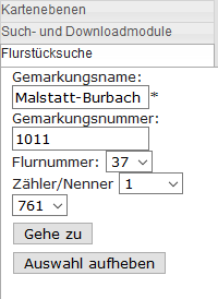
| 12:37, 2. Jun. 2020 | Flurstückssuche LVGL.png (Datei) |  |
5 KB | 1 | |
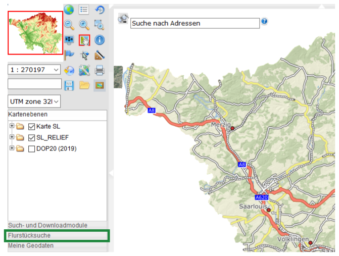
| 12:36, 2. Jun. 2020 | Kartenviewer Flurstueckssuche.png (Datei) |  |
292 KB | 1 | |
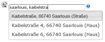
| 12:36, 2. Jun. 2020 | Adresssuche Auswahl.png (Datei) |  |
7 KB | 1 | |
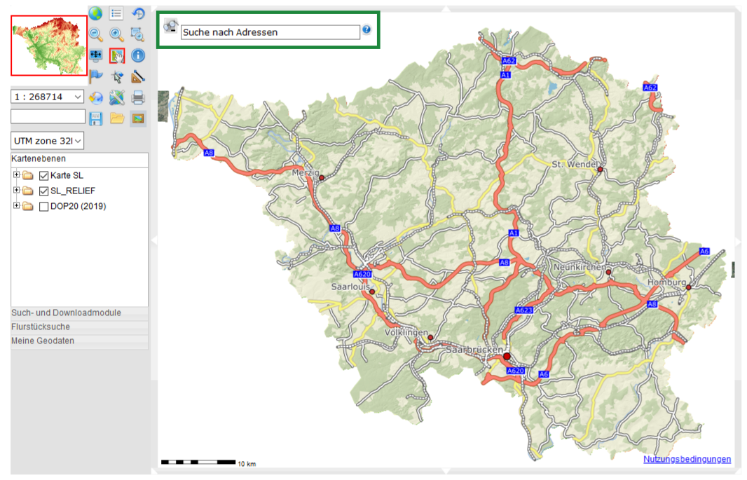
| 12:35, 2. Jun. 2020 | Adresssuche Kartenviewer.png (Datei) |  |
673 KB | 1 | |
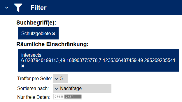
| 12:35, 2. Jun. 2020 | Suchergebnis Filter.png (Datei) |  |
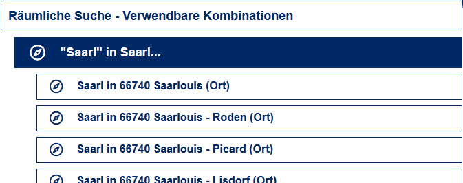
14 KB | Räumliche Einschränkung | 1 |
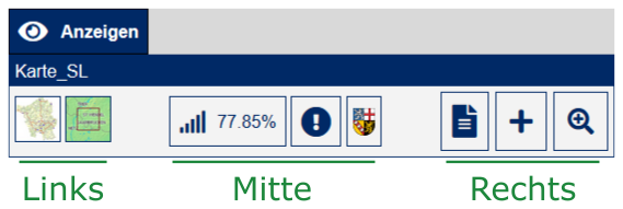
| 12:34, 2. Jun. 2020 | Suchergebnis KarteSL Anzeigen.png (Datei) |  |
28 KB | 1 | |
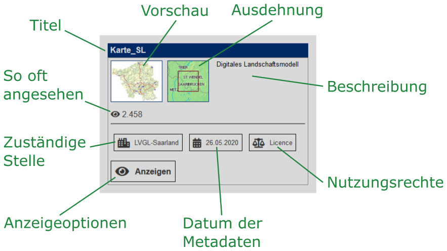
| 12:34, 2. Jun. 2020 | Suchergebnis KarteSL.png (Datei) |  |
106 KB | 1 | |
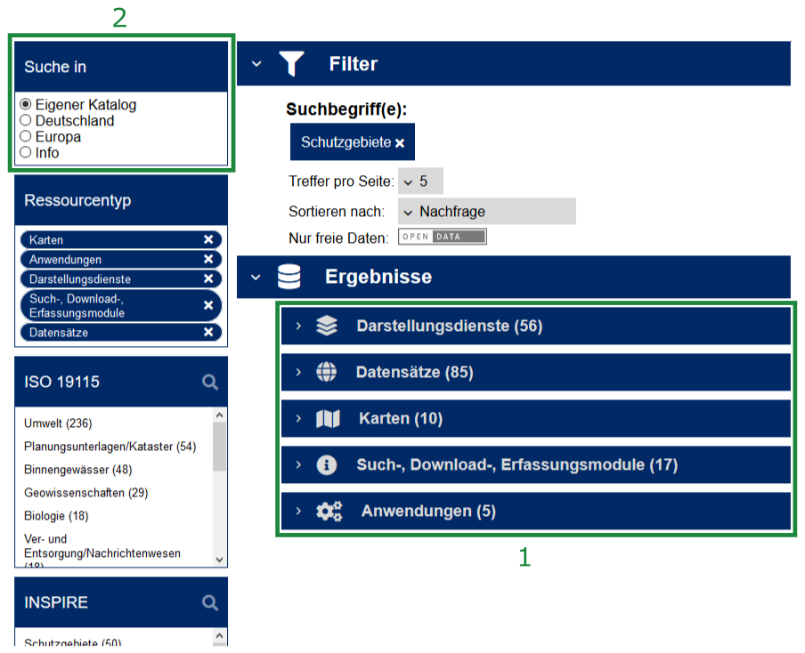
| 12:33, 2. Jun. 2020 | Suche Kategorien.png (Datei) |  |
18 KB | anhand von Schutzgebieten | 1 |
| 12:32, 2. Jun. 2020 | Sucheergebnisse.png (Datei) |  |
126 KB | anhand von Schutzgebieten | 1 |
| 12:31, 2. Jun. 2020 | Suchergebnis raeumlicher Filter.png (Datei) |  |
13 KB | 1 | |
| 12:30, 2. Jun. 2020 | Zentrales Suchfeld raeumlicher Filter.png (Datei) | 3 KB | 1 | ||
| 12:30, 2. Jun. 2020 | Zentrales Suchfeld.png (Datei) | 5 KB | 1 | ||
| 13:18, 27. Mai 2020 | Suchergebnis Schutzgebiete.png (Datei) |  |
43 KB | 1 | |
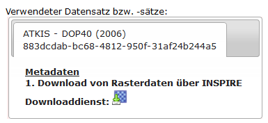
| 13:16, 27. Mai 2020 | Rasterdaten DOP2006.png (Datei) |  |
89 KB | 1 | |
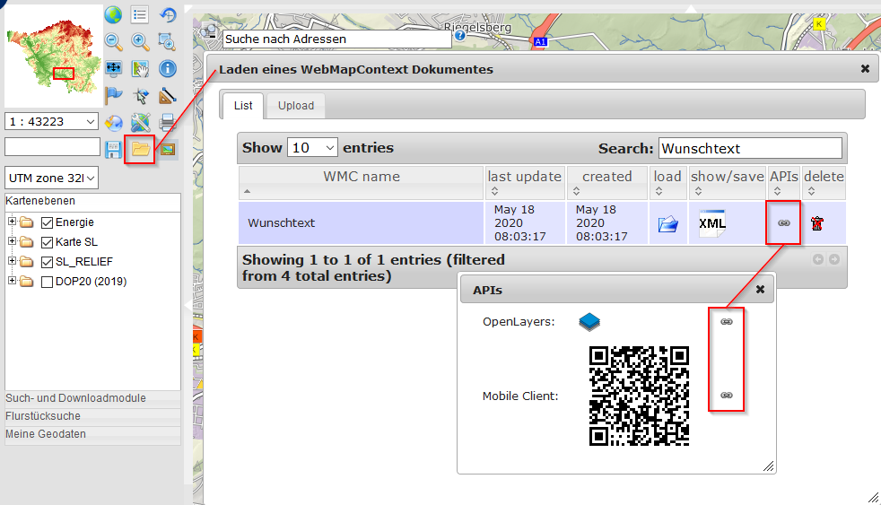
| 09:43, 18. Mai 2020 | WMC teilen.png (Datei) |  |
126 KB | 1 | |
| 09:42, 18. Mai 2020 | WMC bearbeiten.png (Datei) |  |
86 KB | 1 | |
| 09:42, 18. Mai 2020 | WMC aufrufen.png (Datei) |  |
96 KB | 1 | |
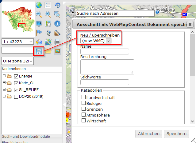
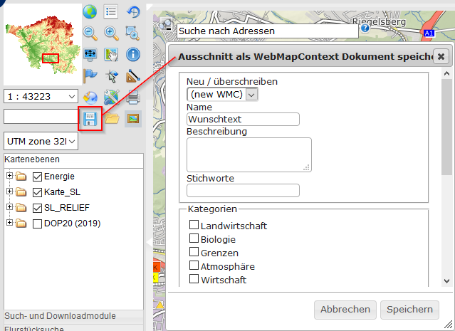
| 09:42, 18. Mai 2020 | WMC erstellen.png (Datei) |  |
87 KB | 1 | |
| 09:42, 18. Mai 2020 | Anmelden.png (Datei) |  |
5 KB | 1 | |
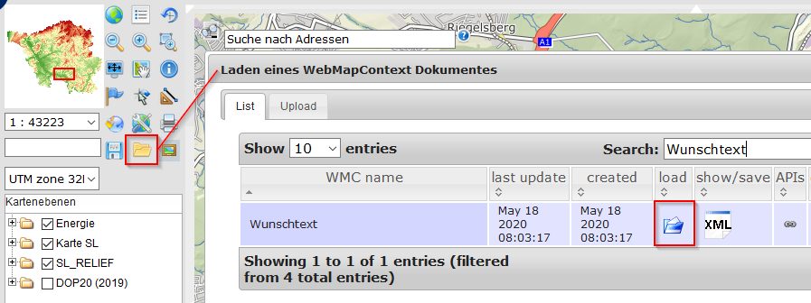
| 09:36, 18. Mai 2020 | Wmc load.png (Datei) |  |
2 KB | 1 | |
| 09:36, 18. Mai 2020 | Link.png (Datei) |  |
343 Bytes | 1 | |
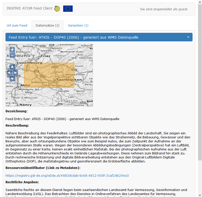
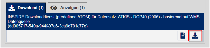
| 12:58, 14. Mai 2020 | Atom Feed DOP2006 Datensätze.png (Datei) |  |
211 KB | 1 | |
| 12:54, 14. Mai 2020 | Atom Feed DOP2006 Varianten Raster.png (Datei) |  |
157 KB | 1 | |
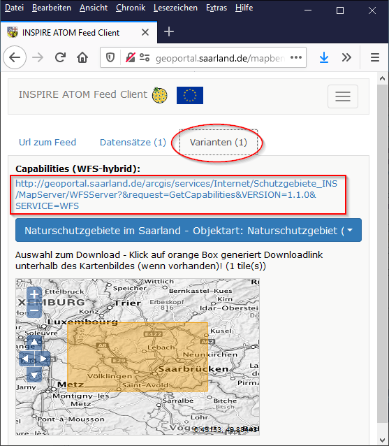
| 10:25, 14. Mai 2020 | Atom Feed Naturschutzgebiete Varianten GML.png (Datei) |  |
189 KB | 1 | |
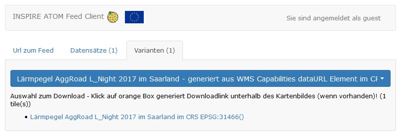
| 10:25, 14. Mai 2020 | Atom Feed Lärmkartierung Varianten ZIP.png (Datei) |  |
15 KB | 1 | |
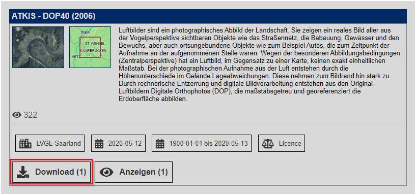
| 10:23, 14. Mai 2020 | Downloadmöglichkeiten DOP2006.png (Datei) |  |
7 KB | 1 | |
| 10:23, 14. Mai 2020 | Rasterdaten DOP2006 Downloadmöglichkeiten.png (Datei) | 11 KB | 1 | ||
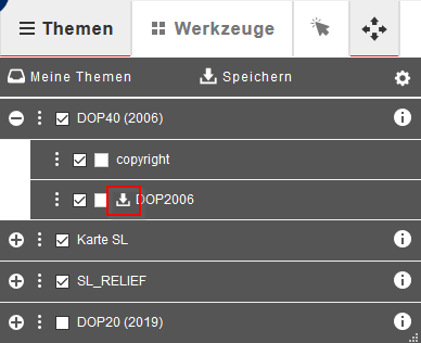
| 10:22, 14. Mai 2020 | Kartenebenen download DOP2006 modern.png (Datei) |  |
9 KB | 1 | |
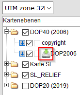
| 10:22, 14. Mai 2020 | Kartenebenen download DOP2006 klassisch.png (Datei) |  |
6 KB | 1 | |
| 09:45, 14. Mai 2020 | Link Download.png (Datei) |  |
919 Bytes | 1 | |
| 08:20, 13. Mai 2020 | ATOM Feed Client Varianten.png (Datei) |  |
145 KB | 1 | |
| 07:40, 13. Mai 2020 | Raster Download.png (Datei) |  |
1 KB | 1 | |
| 14:18, 12. Mai 2020 | Download Kartenviewer modern.png (Datei) |  |
502 Bytes | 1 | |
| 13:53, 12. Mai 2020 | Umstellung des Geoportals.pdf (Datei) | 1,31 MB | mit anklickbarem Inhaltsverzeichnis | 1 | |
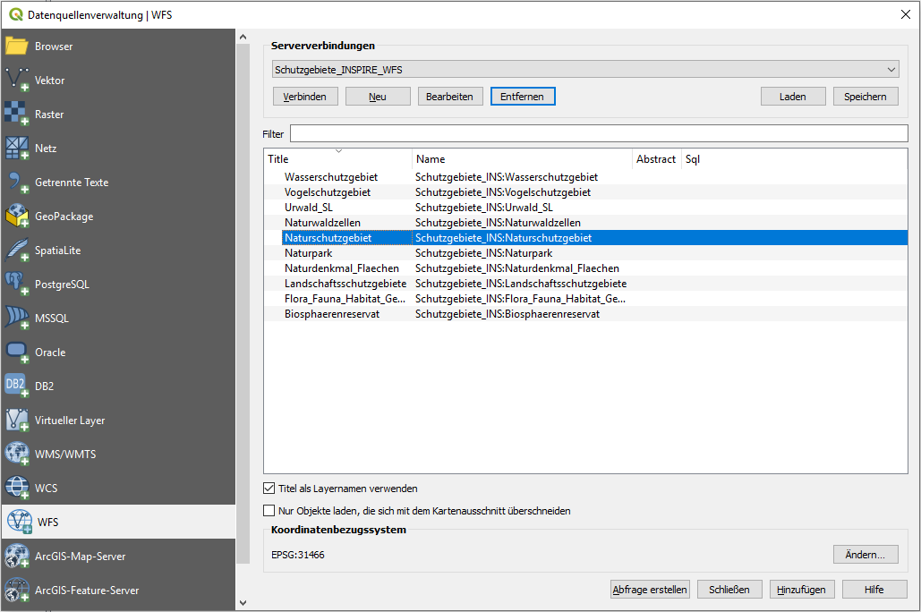
| 10:50, 12. Mai 2020 | QGIS WFS.png (Datei) |  |
54 KB | 1 | |
| 10:50, 12. Mai 2020 | QGIS WFS neu.png (Datei) |  |
16 KB | 1 | |
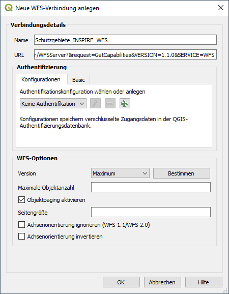
| 10:50, 12. Mai 2020 | QGIS WFS anlegen.png (Datei) |  |
45 KB | 1 | |
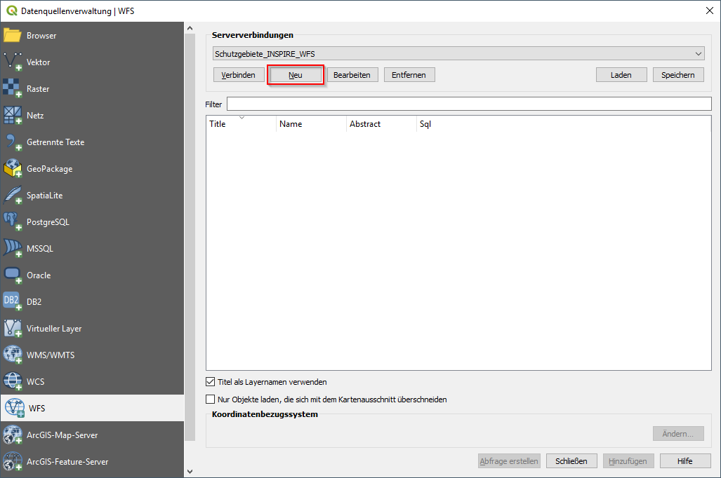
| 10:49, 12. Mai 2020 | QGIS WFS Layer Button.png (Datei) |  |
1 KB | 1 | |
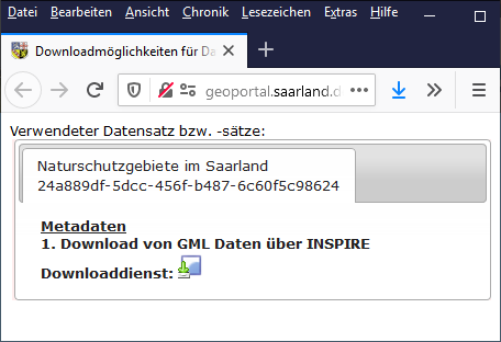
| 10:21, 12. Mai 2020 | Downloadmöglichkeiten Naturschutzgebiete.png (Datei) |  |
30 KB | 1 | |
| 10:21, 12. Mai 2020 | Vector Download.png (Datei) |  |
1 KB | 1 | |
| 08:18, 12. Mai 2020 | Download Kartenviewer.png (Datei) |  |
2 KB | 1 | |
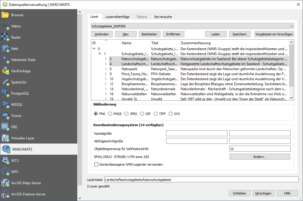
| 13:00, 11. Mai 2020 | QGIS WMS.png (Datei) |  |
70 KB | 1 | |
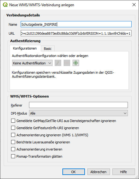
| 13:00, 11. Mai 2020 | QGIS WMS neu.png (Datei) |  |
18 KB | 1 | |
| 13:00, 11. Mai 2020 | QGIS WMS anlegen.png (Datei) |  |
49 KB | 1 | |
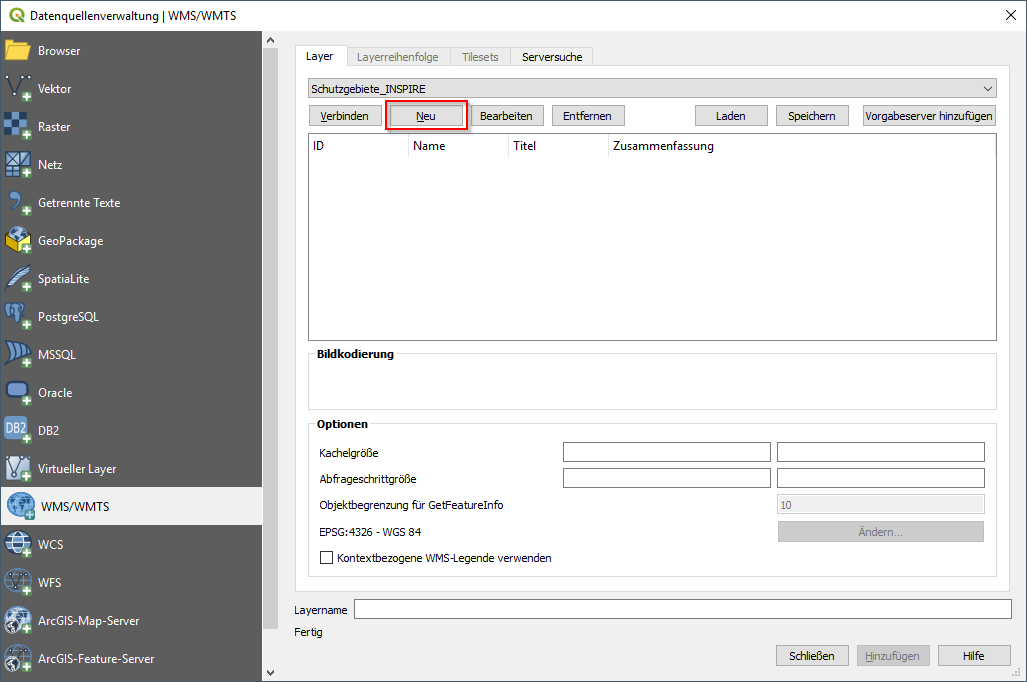
| 12:59, 11. Mai 2020 | QGIS WMS Button.png (Datei) |  |
1 KB | 1 | |
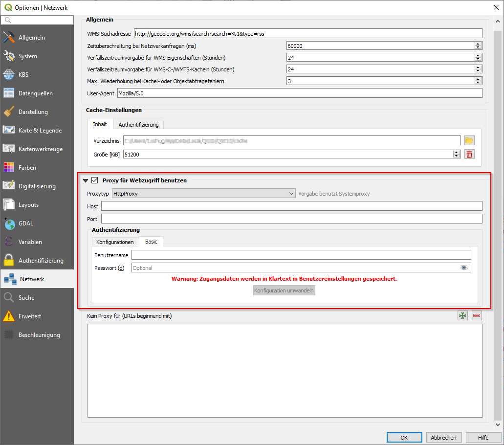
| 12:58, 11. Mai 2020 | QGIS Netzwerkeinstellungen.png (Datei) |  |
52 KB | QGIS 3.10.4 | 1 |
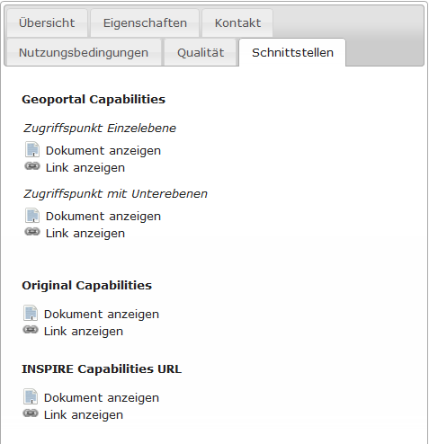
| 12:58, 11. Mai 2020 | Metadaten Schutzgebiete Schnittstellen.png (Datei) |  |
17 KB | 1 |