Nicht kategorisierte Dateien
Aus Geoportal
Unten werden bis zu 50 Ergebnisse im Bereich 401 bis 450 angezeigt.
Zeige (vorherige 50 | nächste 50) (20 | 50 | 100 | 250 | 500)
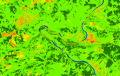 Sentinel-2 Abb7.png 649 × 411; 190 KB
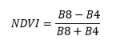 Sentinel-2 Formel1.PNG 150 × 55; 1 KB
 Sentinel 2.jpg 676 × 370; 254 KB
 Show.png 44 × 40; 633 Bytes
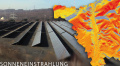 Sonneneinstrahlung.jpg 676 × 370; 304 KB
 Starkregen.jpg 4.128 × 2.322; 2,3 MB
 Starkregen Kommunen.jpg 1.600 × 1.200; 659 KB
 Stockfoto Umspannanlagen.jpg 3.999 × 2.666; 3,86 MB
 Strateg 400x266.JPG 400 × 300; 107 KB
 Suche Kategorien.png 216 × 882; 18 KB
 Sucheergebnisse.png 904 × 734; 126 KB
 Suchergebnis Filter.png 624 × 349; 14 KB
 Suchergebnis KarteSL.png 883 × 496; 106 KB
 Suchergebnis KarteSL Anzeigen.png 569 × 191; 28 KB
 Suchergebnis Schutzgebiete.png 861 × 369; 43 KB
 Suchergebnis raeumlicher Filter.png 673 × 266; 13 KB
 Test.png 28 × 28; 2 KB
 Text LEP 01032021.pdf ; 2,21 MB
 Times red.png 44 × 44; 612 Bytes
 UA Auslastung Rehlingen.jpg 600 × 419; 26 KB
 Umspannanlagen.jpg 676 × 370; 210 KB
- Umstellung des Geoportals.pdf ; 1,31 MB
- Unterrichtsvorschlag GeoPortal LPM.pdf ; 3,99 MB
 User off.png 28 × 28; 1 KB
- VIEHBESATZRAUHFUTTERFRESSER.pdf ; 238 KB
 Vector Download.png 24 × 24; 1 KB
 Vewsaar-111209-logo.jpg 1.795 × 376; 753 KB
 Views.png 68 × 18; 643 Bytes
 WMC aufrufen.png 897 × 336; 96 KB
 WMC bearbeiten.png 639 × 465; 86 KB
 WMC erstellen.png 639 × 465; 87 KB
 WMC teilen.png 982 × 563; 126 KB
 Waermekataster.jpg 585 × 382; 184 KB
- Waermekataster Saar Endbericht.pdf ; 32,99 MB
- Wald Landwirtschaft Juni09.pdf ; 5,25 MB
 Waldbrand.jpg 1.247 × 936; 400 KB
 Waldbrandeinsatzkarte.jpg 676 × 370; 282 KB
 Waldwirtschaft.png 136 × 95; 25 KB
 Wappen Bous.jpg 2.226 × 2.502; 394 KB
 Wappen Ottweiler.png 500 × 871; 73 KB
 Wassertropfen-wvgw.jpg 1.280 × 882; 480 KB
- WebAtlasDE.pdf ; 756 KB
 Webatlas.png 561 × 692; 70 KB
 Windkraft.jpg 400 × 266; 40 KB
 Wmc load.png 22 × 22; 2 KB


Zeige (vorherige 50 | nächste 50) (20 | 50 | 100 | 250 | 500)